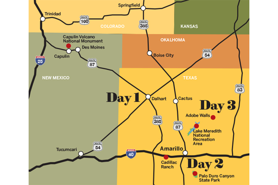
Three Days In: North Texas

There’s a saying, “Everything is bigger in Texas.” For my road trip to Amarillo, I needed a Texas-sized car, and thanks to Automotive Media Solutions, I was living large in a GMC Yukon XL Denali. Intimidated by its size at first, I quickly became a fan of its bells and whistles, as my friend Kristen and I headed south on I-25 toward the Texas Panhandle to see the Grand Canyon of Texas, Route 66, and plenty of wide-open spaces filled with spectacular scenery.
Click to enlarge
Day 1
Capulin Volcano to Cadillac Ranch
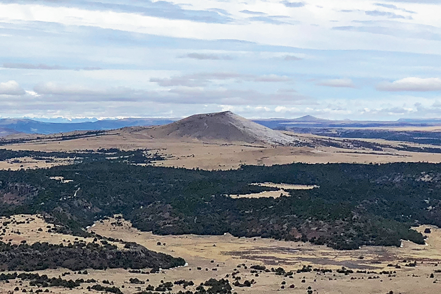
View from the rim at Capulin Volcano National Monument. © Jennifer Broome
About four hours into the drive, we stopped at Capulin Volcano National Monument in northern New Mexico. Capulin sits in the heart of the 8,000-square-mile Raton-Clayton volcanic field. It erupted more than 60,000 years ago. The now-extinct volcano rises more than 1,300 feet above the expansive prairie land. You’ll likely notice Capulin’s symmetry as you drive up to the cinder cone’s base. The reason is because lava flows after the initial eruption came from the cone’s western base, preserving the cinder cone you see today.
The two-mile drive up Volcano Road is a white-knuckle, heart-racing kind of drive as you climb to 7,877 feet. There were only four other people at the rim. No crowd is a big benefit of visiting Capulin this time of year. In winter, there can be snow and ice on the Crater Rim and Crater Vent trails. If clear of ice, hike the Crater Vent Trail so you can hike inside a volcano. The 0.2-mile trail descends 105 feet to the now plugged vent in the crater. On the one-mile Crater Rim Trail, you hike up to the volcano’s highest point of 8,182 feet. Both trails were icy the day we visited, so after looking into the crater, we took in the panoramic view of volcanic domes, cones, and lava flows dotting the landscape, then headed back on our journey toward Amarillo.
We arrived at Cadillac Ranch, west of Amarillo, just as the sun was starting to set over the 10 spray-painted junkers nose down in the field. You have to walk about 200 yards in a dusty, and sometimes muddy, corn field to get up close to the graffiti-covered Cadillacs.
The quirky roadside attraction on Route 66 is the brainchild of Texas millionaire Stanley Marsh. The eccentric millionaire hired three artists from Ant Farm, an artist collective in San Francisco, who then acquired 10 used 1948–1963 Cadillacs from junkyards for about $200 each. The cars were supposed to represent the “Golden Age” of the American automobile, and were painted turquoise, banana yellow, gold, and sky blue, then buried front end first in 1974. One of the original artists dubbed Cadillac Ranch the “hood ornament of Route 66.” Now, visitors are encouraged to participate in the art. Bring a can of spray paint and leave your mark on one of the inverted Cadillacs. The iconic cars continue to defy time in a harsh environment despite years of extreme weather, with even the oldest Cadillac being set on fire this past September.
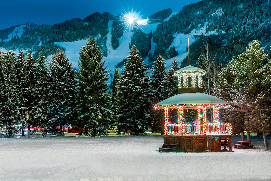
After a day of driving, the AAA Three Diamond-rated Courtyard Amarillo Downtown, in the historic 1927 Fisk Building, was a welcomed sight. After checking into our oversized room, we grabbed a quick bite for dinner. There are a lot of eatery options within two or three blocks of the hotel, from Mexican food to steaks to pub grub.
Day 2
Palo Duro Canyon to Lake Meredith
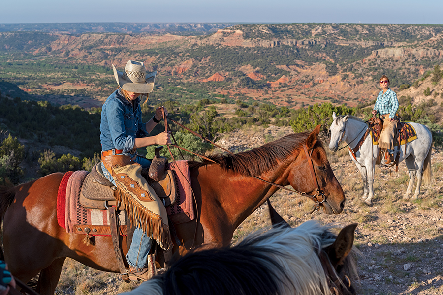
Trail rides are another way to see Palo Duro Canyon State Park. © Kerrick James
We left the hotel the next morning and headed to Palo Duro Canyon State Park, 17 miles southeast of Amarillo. As the sun crested the horizon, we pulled off the road to see a spectacular watercolor in the sky that made me sing a few lines of George Strait’s hit “Amarillo by Morning.”
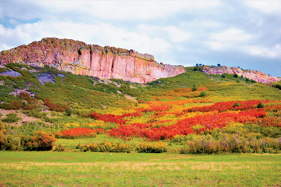
Palo Duro Canyon is called the “Grand Canyon of Texas” and is the second largest canyon in the United States. It’s 120 miles long, 600 to 800 feet deep, and 20 miles wide at its widest point—although, it’s only about a mile wide in the park area. “Palo Duro” means “hard wood” in Spanish, and gets its name from the Juniper trees found in abundance throughout the canyon. We stopped at the scenic overlook at the Visitor Center to take in the expansive view of the undulating land and its 250 million years of geologic history. The canyon formed less than one million years ago when the Prairie Dog Town Fork of the Red River carved its way through the region. Our quiet moment was broken by the howling of a pack of coyotes somewhere down in the canyon, but sounded like they were just feet away. Time to go.
We drove the curvy, 16-mile road down to the canyon’s floor to hike the Pioneer Nature Trail, a flat half mile loop decorated with red yucca and prickly pear cacti. As we parked at the amphitheater, I noticed we didn’t have cell service, but we had Wi-Fi in our Yukon Denali. As an avid hiker in remote areas, I made a mental note to get this feature in my next car. November is one of the best times of year to get solitude in the canyon, as we only saw two people on the trail, and a couple of cars on the road. Plus, the temperatures are a lot more comfortable, considering in summer it can reach 110 degrees Fahrenheit on the canyon floor.
Getting hungry, we stopped at Palo Duro Trading Post. I devoured my egg and pepper jack cheese breakfast sandwich. “Most people come to do the Lighthouse Trail,” said Nerissa, owner of the Trading Post. But first, she suggested driving the loop road to see a huge cave and hike the Sunflower Trail.
Our first stop on the loop was at the site of the Battle of Palo Duro, a decisive battle of the Red River War, where on the dawn of Sept. 28, 1874, the 4th U.S. Cavalry attacked a secret canyon encampment of the southern Plains Indians.
Nerissa had told us to keep an eye out for the cave on the cliffside, just past the Juniper/Cliffside Trail. It’s not on the map, and if the sun is shining on it, you may not see it. There is a small parking area, so you can hike up about 200 yards of the slickrock to the cave. Climbing into the cave, we cooled off instantly and gazed at the beautiful view of the canyon floor. We hiked about a quarter of a mile on the 1.2-mile Sunflower Trail, then headed over to the Lighthouse Trail and hiked about a half mile to the Capitol Peak Viewpoint to take in stunning scenery of red sandstone.
Our last stop in Palo Duro was back at the Visitor Center and El Coronado Lodge. Built in 1934 by the Civilian Conservation Corps (CCC), the lodge is filled with history on the geology, people, and even the dinosaurs that once roamed the region.
We were hoping to make a guided tour at Alibates Flint Quarries National Monument, but this was our one road trip goof. We spent more time in Palo Duro than we expected and arrived about 20 minutes too late for the ranger-led tour. It’s a little under an hour and a half drive north between Palo Duro and Alibates. About 13,000 years ago, Paleo-Indians quarried flint for spear points at Alibates. It’s the only national monument in Texas to preserve native peoples’ quarries. I recommend making a reservation and arriving at least 30 minutes before your scheduled mile-long tour.
Instead, we hiked the 0.3-mile Mesquite Trail and took a journey back to the early ranching days of the Texas Panhandle on what used to be the LX Ranch, dating back to 1877. We saw the Permian Rock Beds, Ogallala Formation, buffalo grass, and “Cowboy Plum” trees along the trail. After the hike, we sat under a large mesquite tree, growing here since the Ice Age, and enjoyed the view of the Canadian River.
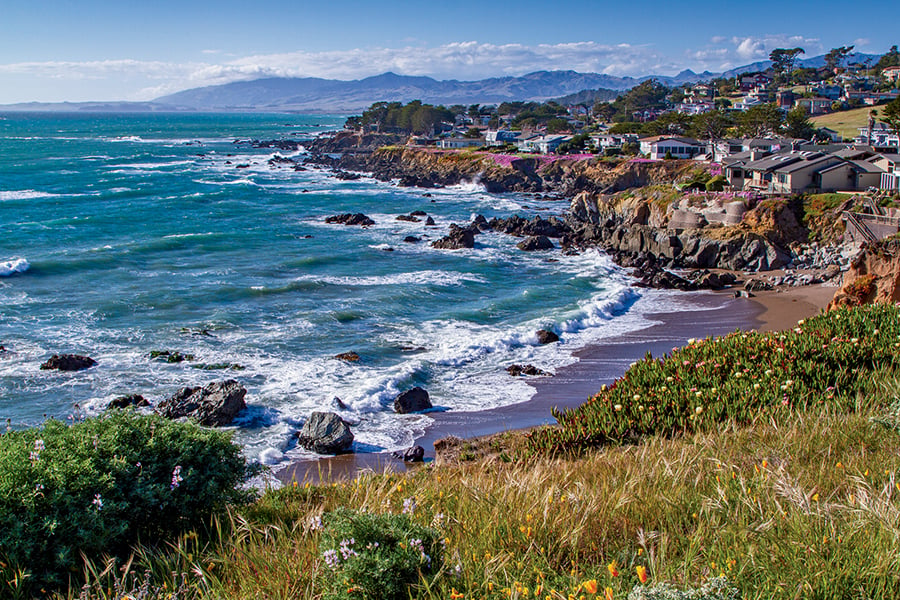
The allure of the water sent us on a fun journey exploring the Lake Meredith National Recreation Area. We headed to McBride Canyon first, to see a pioneer home dating back to 1903. Then it was off to see the Sanford Dam from Fritch Fortress boat ramp, but not before stopping at Harbor Bay for a peaceful and reflective moment in the picturesque setting.
Back in Amarillo, after dinner we explored South 6th Street—a revitalized section of Route 66 filled with antique shops, boutiques, restaurants, and cafés. As we walked into The 806 Coffee Lounge, I couldn’t help thinking this place defies the cowtown stereotype of Amarillo. Something pulls you into this place where grunge rock meets quirky alternative. Perhaps it’s the friendliness of the hipster baristas along with the interesting coffee drink names and plethora of teas to sip.
Day 3
Hike to Lighthouse and Adobe Walls
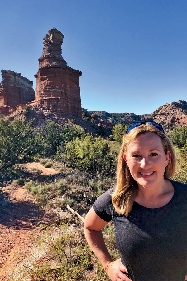
The author basks in the sunshine during a hike to Palo Duro’s iconic Lighthouse rock formation. © Jennifer Broome
When we arrived at the Lighthouse Trailhead in Palo Duro Canyon at 8:00 a.m., the temperature was close to 40 degrees Fahrenheit, and we were the only ones on the red dirt trail. About 1.5 miles in, we got our first good view of the iconic rock formation. At a shaded picnic area, we realized there was about a 300-foot climb to get a better view of the Lighthouse. It’s not well marked, and as I was trying to find the right route, a guy named Daniel came up on his mountain bike. He joined us on the climb and told us how he had hiked it about 20 years ago with his two sons. That climb is worth it to get a spectacular view of the stone pillar resembling a lighthouse. The second rock formation looks like a cargo ship or a shoreline cliff. The vista views across the canyon are superb, and as Kristen and I hiked the 2.72 miles back to our car, the temperature rose into the mid-60s, but it felt like we were baking on the red clay and sandstone. In summer, this trail is notorious for sun- and heat-related injuries and deaths to people and pets. Make sure you bring plenty of water.
After the hike, we headed over to the Panhandle Plains Historical Museum—the largest history museum in Texas, in the small town of Canyon. You can explore a pioneer town, learn the Panhandle’s petroleum story, and see a Phytosaur—a giant crocodile-like creature that lived here when the Panhandle was a swampy, tropical rainforest. My favorite piece in the museum is the Comanche chief headdress of Quanah Parker, but I also really liked the 1910 and 1892 bicycles with their oversized front wheels.
As we looped back up towards Colorado, we stopped to see the Adobe Walls. The ghost town is 17 miles northeast of Stinnett. The trading post for buffalo hunters and local Indians was established in 1843. In 1864, Colonel Christopher “Kit” Carson and his men battled Kiowa and Comanche Indians in the First Battle of Adobe Walls. Ten years later, Comanche Chief Quanah Parker lead a force of 700 Comanche, Cheyenne, Kiowa, and Arapaho warriors in an attack on the buffalo camp. The Indians were defeated, and that battle led to the Red River War of 1874–1875. At the archeological site of the 1874 Adobe Walls Historic Battle Field, there’s the Buffalo Hunter and Indian Warriors Monuments, several graves, and the remnants of a couple of shops, saloon, stables, and mess hall. It was a solemn last stop in the Texas Panhandle, as it was just us and the curious cows eyeing us as we walked around the site.